Joan Perez

About Joan Perez

Joan Perez is an independent quantitative geographer and AI researcher, founder of Urban Geo Analytics. His work focuses on the intersection of artificial intelligence, geospatial data science, and urban analytics, with research spanning urban morphology, demographic dynamics, remote sensing, and machine learning. He develops computational methods and open-source tools to better understand cities and support data-driven urban planning.

Controlling QGIS with Python using the Jupyter Notebook

Have you ever wondered about controlling QGIS with a Python script ? In this blog post, we'll explore how to call QGIS from a Python script in the Jupyter Notebook.

By |2025-11-07T10:24:04+00:00April 23, 2024|Categories: GIS, Intermediate, Python|Tags: , , , , |0 Comments

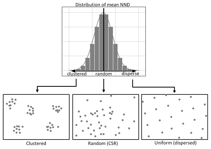
Exploring Spatial Patterns of Point Distributions using NDD and CSR

Calculating Nearest Neighbor Distance (NND) and comparing it with Complete Spatial Randomness (CSR) can be useful in various fields. In this tutorial, we will see together how to calculate a nearest neighbor distance from a given point pattern and compare it to a random distribution (CSR).

Getting Started with Python using Anaconda and Jupyter Notebook

In this guide you'll find clear instructions on setting up Python with Anaconda for spatial analysis. Then, we'll cover installing Python alongside Anaconda and adding essential dependencies like GeoPandas via the Anaconda Prompt. Lastly, we'll explore using the Jupyter Notebook for practical application.