
Urban Geo Analytics
Spatial Analysis, GeoAI & Machine Learning
Our Mission
Urban Geo Analytics builds open, intelligent tools for understanding and shaping cities. We merge geospatial technologies, machine learning, and open data to help organizations make informed decisions about the urban environment — whether you’re planning infrastructure, analyzing accessibility, or building participatory tools for community engagement.
We believe in transparency, reproducibility, and public value. That’s why our tools are designed to be modular, open-source, and grounded in real-world applications. From accessibility metrics to spatial equity diagnostics, our work supports data-driven urbanism at multiple scales.
Founder & Scientific Direction
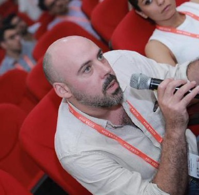
Joan Perez — PhD · Geographer & GeoAI Researcher
Joan founded Urban Geo Analytics and leads its research and scientific direction. A quantitative geographer with more than a decade of experience across Europe and Asia, he specializes in spatial analysis, machine learning, and geospatial intelligence. He has published peer-reviewed research spanning urban morphology, demographic dynamics, and generative AI for streetscape assessment, and is the author of UGA’s open-source tools — including SAGAI, UVLM, and PPCA — used in Horizon Europe research consortia and international consulting assignments, including for the World Bank. Every UGA project runs under his scientific supervision.





Our Collaborators
UGA’s collaborators bring the specialized engineering and domain skills that turn research into deployed, production-grade tools. Urban Geo Analytics operates as a flexible structure: additional collaborators and partners join the team on a project basis, allowing us to scale expertise to the needs of each assignment.
Maurice Stolk — Full-stack Engineer · Web & Decentralised Systems

Maurice builds and ships the web applications behind UGA’s tools, covering frontend, backend, deployment, and scaling. With hands-on experience in the decentralized web he turns UGA research prototypes into robust, scalable applications.
Broussais Dang — Webmaster & Graphic Designer · Publications & Visual Identity


Broussais manages UGA’s web presence and shapes the visual identity of its work. He designs the layout of our reports, deliverables, and training materials, and produces the graphics, figures, and visual assets that make our work readable and compelling.
Founder & Scientific Direction
Urban Geo Analytics was founded and is led by Joan Perez, and works with a growing network of specialized collaborators. Together, we combine research-grade spatial science with solid engineering — from the design of AI-based urban diagnostics to the deployment of the tools that run them.
Joan Perez — Founder · PhD, Geographer & GeoAI Researcher
Joan founded Urban Geo Analytics and leads its research and scientific direction. A quantitative geographer with more than a decade of experience across Europe and Asia, he specializes in spatial analysis, machine learning, and geospatial intelligence. He has published peer-reviewed research spanning urban morphology, demographic dynamics, and generative AI for streetscape assessment, and is the author of UGA’s open-source tools — including SAGAI, UVLM, and PPCA — used in Horizon Europe research consortia and international consulting assignments, including for the World Bank. Every UGA project runs under his scientific supervision.
Our Collaborators
UGA’s collaborators bring the specialized engineering and domain skills that turn research into deployed, production-grade tools. Urban Geo Analytics operates as a flexible structure: additional collaborators and partners join the team on a project basis, allowing us to scale expertise to the needs of each assignment.
Maurice Stolk — Full-stack Engineer · Web & Decentralised Systems
Maurice builds and ships the web applications behind UGA’s tools, covering frontend, backend, deployment, and scaling. With hands-on experience in the decentralized web he turns UGA research prototypes into robust, scalable applications.
Broussais Dang — Webmaster & Graphic Designer · Publications & Visual Identity
Broussais manages UGA’s web presence and shapes the visual identity of its work. He designs the layout of our reports, deliverables, and training materials, and produces the graphics, figures, and visual assets that make our work readable and compelling.
Our Approach
We focus on building replicable, scalable tools for:
- Urban diagnostics & accessibility modeling
- AI-powered image and streetscape analysis
- Blockchain for urban data traceability
- Geospatial data scraping, processing & visualization
- Custom Python pipelines and server-based UI deployment
We work with institutions, NGOs, municipalities, and research labs to turn spatial data into actionable intelligence. Our services range from tool development and technical consulting to training workshops and academic partnerships.
We have worked with











We have worked with
Based in France, Open to the World
Urban Geo Analytics is a registered sole proprietorship based in France, operating globally with open-source technologies and cloud-based services. We welcome collaborations in English or French.
📍 France
🌐 www.urbangeoanalytics.com
Interested in working together?
Let’s talk →