Urban Geo Analytics offers scalable solutions for turning spatial data into insight. Whether you’re planning more walkable cities, analyzing infrastructure, or building your own geospatial workflows — our tools, methods, and support systems are built to empower decision-makers and developers alike.
Turning Spatial Data into Urban Intelligence
At Urban Geo Analytics, we design and develop open-source tools for geospatial data processing and urban analysis. Whether you’re mapping a city, analyzing infrastructure, or building an urban accessibility model, our goal is to help you turn raw spatial data into actionable insights.
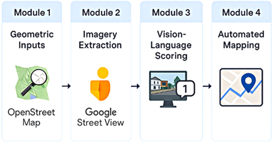
We work across the full stack of geospatial technologies — from data extraction and cleaning to spatial analytics and web-based visualization. This includes advanced techniques in data mining, automated web scraping for open geodata acquisition, and the integration of machine learning models to classify, predict, and enhance spatial information. Our approach combines geographic intelligence with computational efficiency to support both research and operational needs in urban contexts.

Our Tech Stack & Methods
We use Python, QGIS, and Google Earth Engine to automate and scale complex workflows. Our scripts and toolkits rely on trusted libraries such as osmnx, geopandas, and folium, and we frequently deploy solutions through Google Colab or Jupyter Notebooks for ease of use and collaboration. We incorporate web scraping, remote sensing, and data mining techniques to enrich spatial datasets. Our workflows are modular, allowing users to adapt and integrate components into their own systems.
For enterprise clients, we also set up tailored user interfaces (UIs) deployed on in-house or cloud servers, enabling teams to access, interact with, and visualize spatial data in secure, production-ready environments. In addition, we provide documentation, technical notes, and on-demand workshops to train teams on how to use and adapt our algorithms effectively.
Deliverables & Benefits
-
Structured data outputs – Clean GeoPackages, GeoJSONs, and more.
-
Plug-and-play scripts – Ready-to-use notebooks and automation pipelines.
-
Interactive maps – Custom dashboards for exploration and sharing.
-
Hosted interfaces – Secure UIs deployed on your infrastructure.
-
Team training – Docs, walkthroughs, and on-demand workshops.
What We’ve Built
SAGAI algorithm on Github
PPCA algorithm on Github
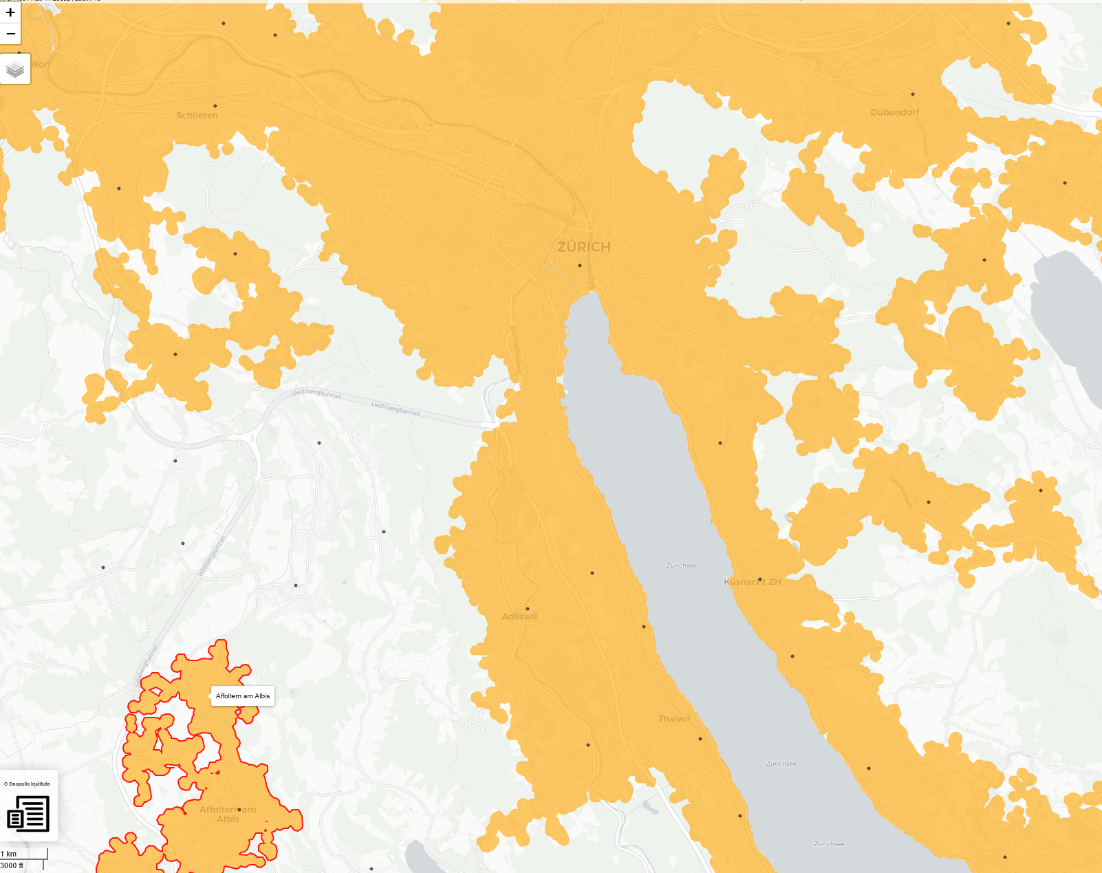
Interactive maps for e-Geopolis
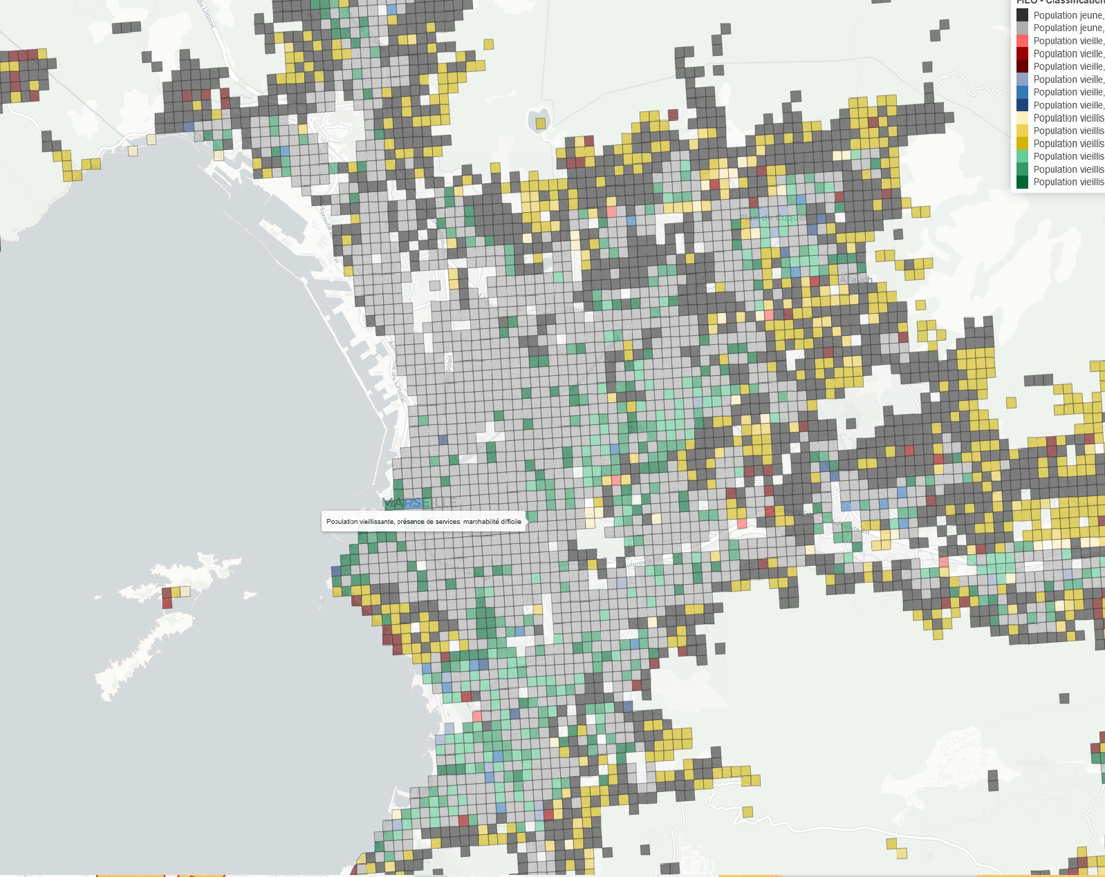
Interactive maps for Region Sud
Whether you’re a city planner, researcher, or startup, we deliver tools that are transparent, documented, and extensible. Ready to bring geospatial intelligence into your workflow? Reach out to discuss your project.